Hack 70. Will the Kids Barf? (and Other Cool Ways to Use Google Maps)


Google Maps Hacks are turning up everywhere; here are some things we just didn't have time to cover fully.
My kids get sick on curvy roads. It is just a fact of life. One measure of the curviness of a road is the detour index. This is the ratio of the shortest road distance and the straight-line distance. Some mathematicians also call this the "fractal dimension of the polyline."
Detour Index = road distance ÷ straight line distance X 100
We can get the road distance by calculating the driving directions and grabbing that distance. Figure 7-30 shows it is 68.1 miles from Cloverdale to Mendocino.
See "How Far Is That? Go Beyond Driving Directions" [Hack #12] for different ways to calculate the straight-line distance. I used our sample tool at http://mappinghacks.com/projects/gmaps/lines.html. Be careful to measure the same distance! I noted the start and stop points of the Google route and tried to match those in calculating the straight-line distance as shown in Figure 7-31.
Figure 7-30. From Cloverdale to Mendocino is 68.1 miles on the road
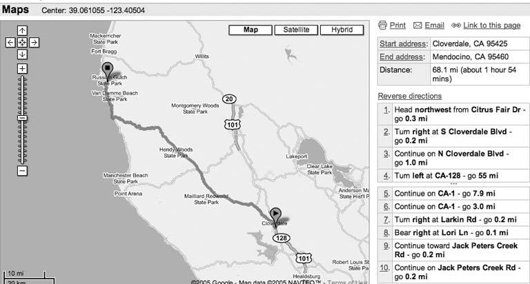
Figure 7-31. Straight-line distance from Cloverdale to Mendocino is 55.1 miles
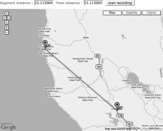
The straight-line distance is 55.1 miles, so the detour index is 68.1÷55.1 X 100=123.6.
Through careful analysis of four or five trips, as partially described in Mapping Hacks, I've determined that a detour index over about 120 is a recipe for carsick fun. If you are a motorcyclist looking for curves, you can use the number for your own ends. But remember, as the heartless half of this book's writing team says, "For some people, motion sickness is no laughing matter. For the rest of us, it is."
We really wanted to turn this into a Google Maps demo that you could experiment with yourself, but we just didn't have the time!
7.10.1. Other Cool Google Maps Hacks
One of the painful challenges in writing this book during the heady days of the release of the official API was that we just could not keep up with all of the cool work that was being done, much less contribute to it ourselves. We'd watch our email, and the Google Maps API mailing list, and Del.icio.us, and more cool "must include" hacks appeared than we could possibly ever write about. Here are a few of the coolest.
7.10.1.1. Google sightseeing.
What could be better than standing on a sunlit peak overlooking the Grand Canyon at sunset with your loving family by your side? How about looking over it without the 10-hour car trip in an overheating station wagon with sticky seats, grumpy children, and a fed-up wife?
We have Google, so why bother seeing the world for real? The Google Sightseeing site at http://www.googlesightseeing.com/ shows neat places on Google Maps. Consider it a map geeks blog: Alex, James, and Olly scour (imagery of) the Earth to bring you landscapes to amuse and amaze.
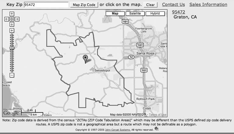
7.10.1.2. ZIP Code maps.
Postal code boundaries are often a bit arbitrary. You can go to http://maps.huge.info/, enter a ZIP Code, and see the area it covers. Figure 7-32 shows 95472 on a map. ("Examine Patterns of Criminal Activity" [Hack #18] shows another example of rendering arbitrary GIS vector data on Google Maps.)
The site is careful to note its own limitations:
ZIP Code data is derived from the Census 'ZCTAs (ZIP Code Tabulation Areas),' which may be different than the USPS defined ZIP Code delivery routes. A USPS ZIP Code is not a geographical area but a route which may not be definable as a polygon.
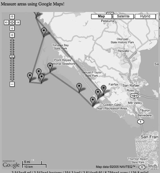
7.10.1.3. Google Planimeter.
You can use Google Maps to measure areas at http://www.acme.com/planimeter/. Navigate to your selected area and then click on at least three points, and it will calculate the area. Figure 7-33 shows that the Point Reyes National Seashore is roughly 137 square miles.
Figure 7-32. ZIP Code 95472 displayed on a map
7.10.1.4. Play games on Google Maps.
In Tripods, you "battle invading Google Maps Tripod markers that are invading Manhattan." This is a multiplayer game, so you can gang up with other players to fight the menace, as shown in Figure 7-34. You can play Tripods at http://www.thomasscott.net/tripods/.
Find the Landmark, at http://landmark.mapsgame.com/, gives you a landmark and times your attempts to find it. Figure 7-35 shows my "I give up" time at finding the Space Needle in Seattle.
Other games are discussed on the Games On Google Maps wiki page at http://moloko.itc.it/trustmetricswiki/moin.cgi/GamesOnGoogleMaps.
7.10.1.5. Map versus satellite.
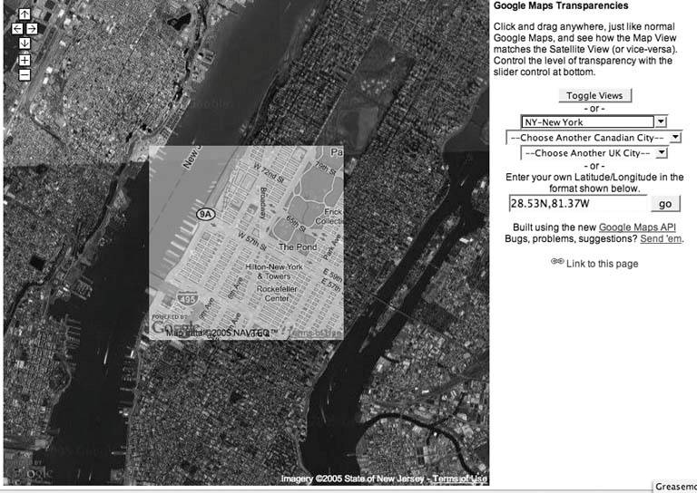
Overlay a small section of a map view over the satellite view, or vice versa, at http://www.kokogiak.com/gmaps-transparencies.html. This helps you to see discrepancies between the map and the imagery, as in Figure 7-36.
7.10.1.6. Edible plants in the public domain.
The Garden of the Commons at http://commonsgarden.org/ maps plants growing in public spaces that have food or medicinal value and offers users the chance to contribute their own finds.
Figure 7-33. Measure the area of Point Reyes National Seashore
7.10.1.7. Animate a route.
There is a bookmarklet at http://www.ergul.com/maps/ that will animate your driving directions, even cross-country. Enter your end points and watch as the computer follows your route for you.
7.10.1.8. Track your credit card spending.
Greg McCarroll has done work on mapping his credit card statement at http://www.mccarroll.org.uk/~gem/creditcardtracker/. Being able to see where you spend money might just help you manage your spending habits!
Figure 7-34. Fight the Tripods!
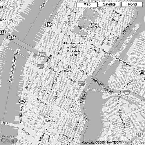
Figure 7-35. Find the LandmarkThe Space Needle
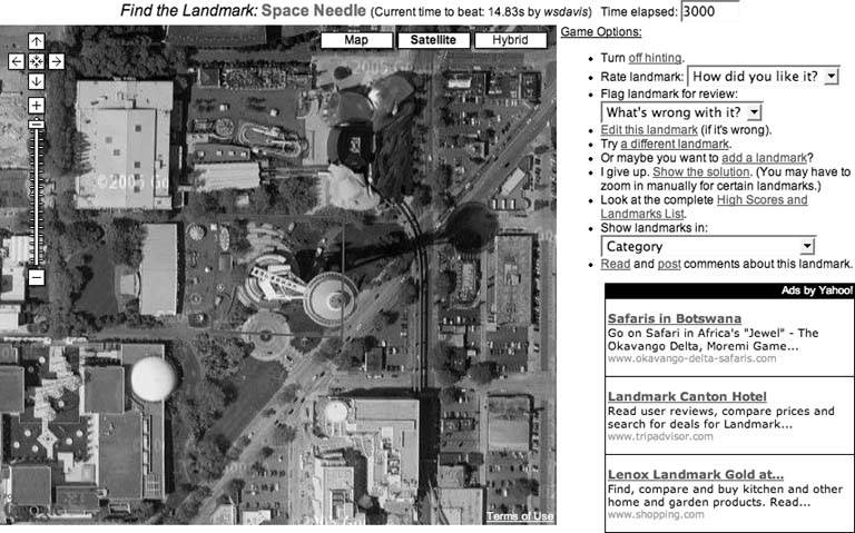
Figure 7-36. Compare the map with the satellite view
7.10.2. Where to from Here?
We can recommend a couple of web sites that track the Google Maps phenomenon in all its glory and bring you up-to-date on the latest developments. The first is Google Maps Mania, at http://googlemapsmania.blogspot.com/, a veritable cornucopia of Google Maps news and reviews. The other, of course, is our very own Mapping Hacks blog, at http://mappinghacks.com/ where we hope to present a more vaired and in-depth view of the rapidly evolving world of digital cartography, including, of course, Google Maps.
So where to now? Google Maps has provided a brush or two, an easel, and a few pots of paint. Get out there and see what you can make!
| Colophon
The tool on the cover of Google Maps Hacks is an antique globe of the earth. Unlike maps, globes allow for undistorted geographical representations of the earth and other spherical celestial bodies. The earliest known globe, the Nurnberg Terrestrial Globe, was made during the years 14901492 by German navigator and mapmaker Martin Behaim. The cover image is from the "CMCD Everyday Objects" CD. The cover font is Adobe ITC Garamond. The text font is Linotype Birka; the heading font is Adobe Helvetica Neue Condensed; and the code font is LucasFont's TheSans Mono Condensed. |
You Are Here: Introducing Google Maps
- Hacks 19: Introduction
- Hack 1. Get Around http://maps.google.com
- Hack 2. Find Yourself (and Others) on Google Maps
- Hack 3. Navigate the World in Your Web Browser
- Hack 4. Get the Birds-Eye View
- Hack 5. Driven to a Better User Interface
- Hack 6. Share Google Maps
- Hack 7. Inside Google Maps URLs
- Hack 8. Generate Links to Google Maps in a Spreadsheet
- Hack 9. Use del.icio.us to Keep Up with Google Maps
Introducing the Google Maps API
- Hacks 1016: Introduction
- Hack 10. Add a Google Map to Your Web Site
- Hack 11. Where Did the User Click?
- Hack 12. How Far Is That? Go Beyond Driving Directions
- Hack 13. Create a Route with a Click (or Two)
- Hack 14. Create Custom Map Markers
- Hack 15. Map a Slideshow of Your Travels
- Hack 16. How Big Is the World?
Mashing Up Google Maps
- Hacks 1728: Introduction
- Hack 17. Map the News
- Hack 18. Examine Patterns of Criminal Activity
- Hack 19. Map Local Weather Conditions
- Hack 20. Track Official Storm Reporting
- Hack 21. Track the International Space Station
- Hack 22. Witness the Effects of a Nuclear Explosion
- Hack 23. Find a Place to Live
- Hack 24. Search for Events by Location
- Hack 25. Track Your UPS Packages
- Hack 26. Follow Your Packets Across the Internet
- Hack 27. Add Google Maps to Any Web Site
- Hack 28. How Big Is That, Exactly?
On the Road with Google Maps
- Hacks 2941: Introduction
- Hack 29. Find the Best Gasoline Prices
- Hack 30. Stay Out of Traffic Jams
- Hack 31. Navigate Public Transportation
- Hack 32. Locate a Phone Number
- Hack 33. Why Your Cell Phone Doesnt Work There
- Hack 34. Publish Your Own Hiking Trail Maps
- Hack 35. Load Driving Directions into Your GPS
- Hack 36. Get Driving Directions for More Than Two Locations
- Hack 37. View Your GPS Tracklogs in Google Maps
- Hack 38. Map Your Wardriving Expeditions
- Hack 39. Track Your Every Move with Google Earth
- Hack 40. The Ghost in Google Ride Finder
- Hack 41. How Google Maps Got Me Out of a Traffic Ticket
Google Maps in Words and Pictures
- Hacks 4250: Introduction
- Hack 42. Get More out of What You Read
- Hack 43. Dont Believe Everything You Read on a Map
- Hack 44. You Got Your A9 Local in My Google Maps!
- Hack 45. Share Pictures with Your Community
- Hack 46. Browse Photography by Shooting Location
- Hack 47. Geotag Your Own Photos on Flickr
- Hack 48. Tell Your Communitys Story
- Hack 49. Generate Geocoded RSS from Any Google Map
- Hack 50. Geoblog with Google Maps in Thingster
API Tips and Tricks
- Hacks 5161: Introduction
- Hack 51. Make a Fullscreen Map the Right Way
- Hack 52. Put a Map and HTML into Your Info Windows
- Hack 53. Add Flash Applets to Your Google Maps
- Hack 54. Add a Nicer Info Window to Your Map with TLabel
- Hack 55. Put Photographs on Your Google Maps
- Hack 56. Pin Your Own Maps to Google Maps with TPhoto
- Hack 57. Do a Local Zoom with GxMagnifier
- Hack 58. Find the Right Zoom Level
- Hack 59. Show Lots of StuffQuickly
- Hack 60. Make Things Happen When the Map Moves
- Hack 61. Use the Right Developers Key Automatically
Extreme Google Maps Hacks
- Hacks 6270: Introduction
- Hack 62. Find the Latitude and Longitude of a Street Address
- Hack 63. Read and Write Markers from a MySQL Database
- Hack 64. Build Custom Icons on the Fly
- Hack 65. Add More Imagery with a WMS Interface
- Hack 66. Add Your Own Custom Map
- Hack 67. Serve Custom Map Imagery
- Hack 68. Automatically Cut and Name Custom Map Tiles
- Hack 69. Cluster Markers at High Zoom Levels
- Hack 70. Will the Kids Barf? (and Other Cool Ways to Use Google Maps)
EAN: 2147483647
Pages: 131
