Displaying Satellite Images
| By default, Google Maps displays a standard map of any location you enter. But that's not the only way you can view a location. Google Maps also incorporates satellite images, which lets you get a bird's eye view on the actual location. It's like having access to your very own spy satellite! The View from AboveTo display the satellite image of a location, click the Satellite button at the top of the map. You can use the standard navigation and zoom controls to pan around and zoom into or out of the satellite image. Depending on the level of magnification, you may be able to see rooftops and trees. (Figure 18.9 shows a satellite map of Shea Stadiumif it were game day, you could almost see the people in the seats!) Figure 18.9. A satellite map of Shea Stadium.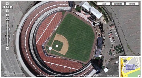 Note Google Maps sources its map from NAVTEQ and TeleAtlas. It sources its satellite images from DigitalGlobe and EarthSat. Note that the satellite images are apt to be less current than the map data. If you zoom in too far, you may reach the limits of the satellite imagery. That is, not all locations have super high-resolution satellite photos. When you zoom in too far, you'll see a screen like the one in Figure 18.10, with the repeated message "We are sorry, but we don't have imagery at this zoom level for this region." If you see this message, zoom out a little to see what you can see. Figure 18.10. Oopsyou zoomed in too far!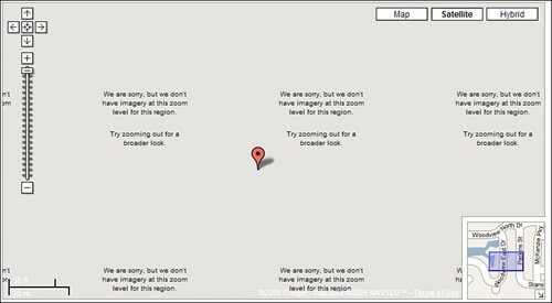 And here's something kind of creepy. Some satellite images have been digitally altered, supposedly for "national security" reasons. For example, Figure 18.11 shows 1 Observatory Circle in Washington, DC, the official residence of the Vice President. As you can see, the entire area has been pixilated on the map to keep anyone (terrorists included, I suppose) from seeing what's going on there. (Interestingly, a similar view of the White House is completely unpixelated, which makes one wonder what it is about the VP's place that makes it more top secret than the President's house...) Figure 18.11. A digitally altered satellite image of the Vice President's residence.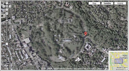 Displaying Hybrid Satellite MapsSatellite maps are fun (try looking up the map for your own house!), but not always as useful as a standard map, especially when you're going to be driving somewhere. What you might want to try, instead, is what Google calls a "hybrid" map. What this is, as you can see in Figure 18.12, is a satellite image with map info overlaid on top of it. It's actually a nice compromise of visual identification and useful data; just click the Hybrid button to see for yourself. Figure 18.12. A hybrid map that overlays street names on a satellite image.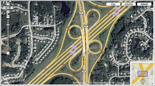 |
EAN: 2147483647
Pages: 370
- Chapter II Information Search on the Internet: A Causal Model
- Chapter IV How Consumers Think About Interactive Aspects of Web Advertising
- Chapter V Consumer Complaint Behavior in the Online Environment
- Chapter VIII Personalization Systems and Their Deployment as Web Site Interface Design Decisions
- Chapter XVI Turning Web Surfers into Loyal Customers: Cognitive Lock-In Through Interface Design and Web Site Usability