10.6 GpsDrive
| < Day Day Up > |
| GpsDrive (http://www.gpsdrive.cc/index.shtml) is an open source GPS-aware navigation system that uses GTK+. It works with maps from a variety of sources, and plot waypoints, and even lets you share your position with friends and send SMS text messages with position information. If you launch GpsDrive while GPSd is listening on the localhost, it will pick it up and start reading coordinates from it. By default, GpsDrive displays a placeholder map that's not very detailed (see Figure 10-9). However, you can download new maps by clicking the Download Map button and selecting the map server from the dialog that pops up, as shown in Figure 10-10. Figure 10-9. Default map from GpsDrive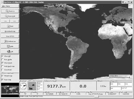 Figure 10-10. Selecting a map to download in GpsDrive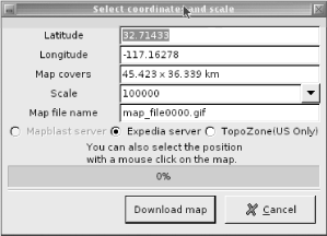
The latest beta version as of this writing (2.08pre12) comes with support for NASA's Blue Marble (http://earthobservatory.nasa.gov/Newsroom/BlueMarble/) satellite images. You must download some extremely large files (over 1 GB uncompressed) and install them according to the README.nasamaps file that's included with the GpsDrive distribution. Figure 10-11 shows the NASA maps in action. GpsDrive does not support route planning, but it does show your speed, position, and altitude. What's more, a version is available that runs on Linux- powered handhelds (http://www.gpsdrive.cc/pda.shtml), so you can load it up with waypoints for points of interest and use it while you wander around unfamiliar territory. Figure 10-11. Using NASA's Blue Marble satellite maps with GpsDrive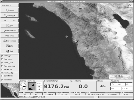 |
| < Day Day Up > |
EAN: 2147483647
Pages: 100